Ecological Services
Central Environmental Surveys offers services in the fields of nature conservation, environmental management and ecological computing. In particular, the consultancy has extensive experience of Habitat surveying, Management planning, Ecological audit and Air photograph rectification and analysis.
Key services include:
- Plant communities surveyed and identified according to the National Vegetation Classification (UK), CORINE or Phase 1 habitat survey
- Computerised vegetation analysis and mapping using the latest GIS software
- Development Constraint Analysis and post development monitoring.
- Ecological audit including LBAP audit
- Air photo rectification
Orthorectification
This allows satellite and aerial photography or design schematics to be draped over three-dimensional maps, then viewed from various angles for landscape evaluations.
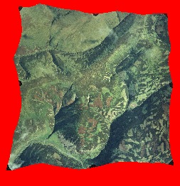
A square 1: 10,000 air photograph with edges of about 2.5km is stretched to conform to the topography by the orthorectification process. The central area is cropped and used as a tile in Arc View or other GIS. The resulting images are accurate to within 7 metres, allowing LBAP habitats to be mapped directly from the rectified coverage, whereas interpretation errors without orthorectification can exceed 150 metres.

Example of a rectified air photograph

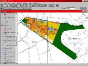
Example of a digitised NVC map

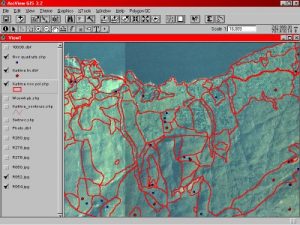
Example of a large scale upland NVC survey using rectified air photographs
Recent Projects
Site Condition Monitoring: Design of sampling schemes for upland and peatland sites – a report to SNH
Digitisation of more than 7000km2 of NVC, Phase1, LBAP and other data at 1:10000 base scale throughout Scotland
LBAP habitat and species audit for Loch Lomond and Stirling Council areas
Biodiversity Action Plan Lead Partner database analysis for The Scottish Executive
GIS analysis and ecological surveys of Scottish Power’s overhead line network as part of the Rural Care Project
Corncrake habitat survey and GIS mapping of the Western Isles
Air photo orthorectification and LBAP mapping of some 6,000km2 of Dumfries and Galloway.
NVC habitat mapping and management briefs for the Ancient Woodland Resource of Stirling District.
NVC surveys of grasslands, heaths, coasts and mires in Orkney, Mull and Sutherland.
Design of NRA standard river corridor survey and river landscape assessment, Clackmannan.
NVC / CORINE survey and analysis of bog woodlands in Scotland.
A wildlife survey of the mainland and island estate of Historic Scotland with the production of management plans and briefs for sites.
Section 50 management plans for private developers.
Habitat surveys and production of an Urban Nature Conservation Strategy for Stirling District Council.
Habitat mapping and production of reports for the Inverclyde section of the Lower Clyde Valleys Project.
Habitat surveys and production of a Nature Conservation Strategy as part of the Kilpatricks Project.
Wildlife survey and report for Edinburgh Green Belt Initiative (in conjunction with Cobham Resource Consultants).
Habitat mapping, vegetation community analysis, research proposals and Management Plan for East Flanders Moss, Tentsmuir, Isle of May, Blawhorn Moss and Caenlochan National Nature Reserves.
